 |
||
Europe
Out of stock
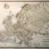
This hand colored map was made by Alexander Keith Johnston for “The National Atlas of Historical, Commercial, and Political Geography”. This very rare lithographed edition was printed in Edinburgh in 1849.Europe is illustrated on this map. The boarders of regions are distinguished by dark color and countries are pastel yellow on this mostly black and white map. Other details include the names of regions and important cities, and illustrations of mountains, lakes, rivers, and major roads.
Size: 24 x 19.5 inches
Condition: Very Good- age toning, small tear at center fold, minor paper loss at edge of margin
Map Maker: A.K. Johnston
Coloring: Original Hand Color
Year: 1849
Condition: Very Good- age toning, small tear at center fold, minor paper loss at edge of margin
Map Maker: A.K. Johnston
Coloring: Original Hand Color
Year: 1849
Out of stock