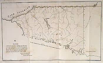
Diagram of the Boundary line between Michigan and Wisconsin
In stock
An unusually geographically specific GLO map showing the boundary line between Michigan and Wisconsin. Labels “The course designated by Capt. Cram” and the trail from L”Anse to Lac Vieux Desert. Rivers and lakes shown.
Size: 13 x 8 inches
Condition: Very Good
Map Maker: General Land Office
Coloring: Black & White
Year: 1847
Condition: Very Good
Map Maker: General Land Office
Coloring: Black & White
Year: 1847
In stock


