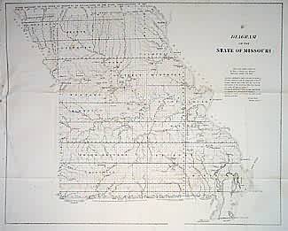
Diagram of the State of Missouri
In stock
This map portrays a Missouri that is nearly completely surveyed, with the only exceptions lying in the extreme southeast and northern parts of the state. Towns and settlements appearing state-wide at this date. The Harmony Mission, old Indian and old western boundary lines, land districts, and lead, iron, coal, copper and salt mines/deposits are marked.
Size: 22 x 17.5 inches
Condition: Very Good
Map Maker: General Land Office
Coloring: Black & White
Year: 1849
Condition: Very Good
Map Maker: General Land Office
Coloring: Black & White
Year: 1849
In stock


