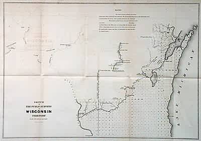
Sketch of the Public Surveys in Wisconsin Territory
In stock
Wisconsin Territory. Surveys extending from Lake Michigan to the Mississippi River south of Wisconsin and Fox Rivers. Labels mills along the Chippewa and St. Croix Rivers and Oneida and Brothertown Indian reserves. Forts Snelling and Winnebago, towns of Green Bay, Dubuque, and Prairie du Chien.
Size: 16 x 13.5 inches
Condition: Very Good, w/slight offsetting, small repaired tear in fold
Map Maker: General Land Office
Coloring: Black & White
Year: 1841
Condition: Very Good, w/slight offsetting, small repaired tear in fold
Map Maker: General Land Office
Coloring: Black & White
Year: 1841
In stock


