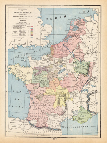
Historical Map of Feudal France During the Hundred Years War with England A.D. 1339 – 1453′
In stock
This map was made by George F. Cram for “Crams Modern Atlas” in 1905. In 1869 the George F. Cram Company was born and the Cram name quickly became synonymous with accuracy and innovation. Significant cities, bodies of water, and topographic features are labeled. The map also labels the present boundary of France, French possessions of Edward III, the Pope’sFrench possessions, and the possessions of the Great French Feudal Houses. A fine map, excellent for framing.
Size: 12.5 x 9 inches
Condition: Very Good
Map Maker: George F. Cram
Coloring: Printed Color
Year: 1905
Condition: Very Good
Map Maker: George F. Cram
Coloring: Printed Color
Year: 1905
In stock


