 |
||
Illinois
In stock
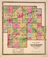
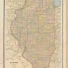
This map was made by George F. Cram for “Cram’s Unrivaled Family Atlas” in 1883. Illinois is illustrated on this map with counties highlighted by color. Other details include the names of counties and important cities, major roads, rivers, and lakes.
Size: 9 x 12 inches
Condition: Very Good- age toning
Map Maker: George F. Cram
Coloring: Printed Color
Year: 1883
Condition: Very Good- age toning
Map Maker: George F. Cram
Coloring: Printed Color
Year: 1883
In stock