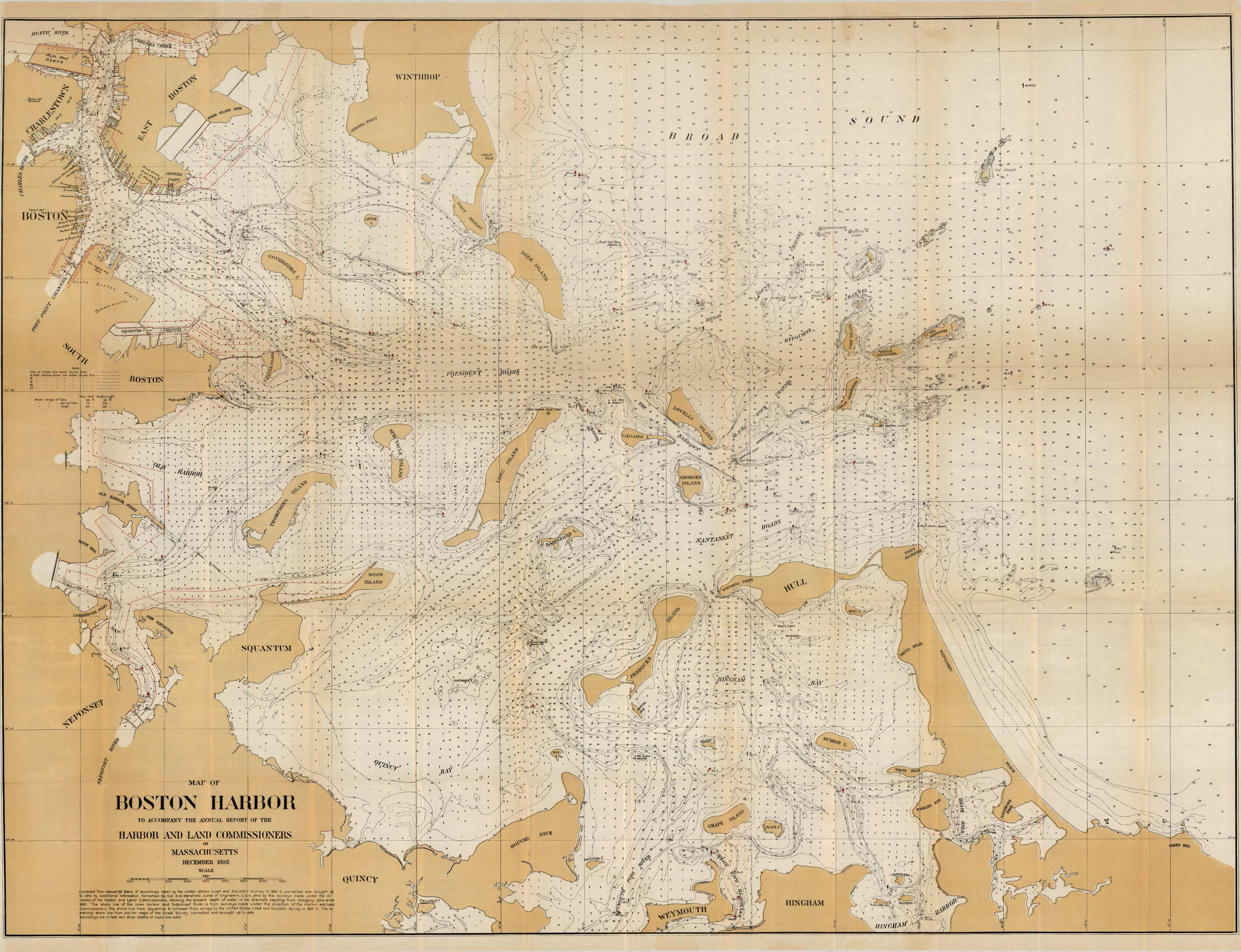
Map of Boston Harbor
Out of stock
This coastal survey was printed in December 1895 by the U.S. Coast and Geodetic Survey to accompany the annual report of the Harbor and Land Commissioners of Massachusetts. Details include the names of surrounding islands, points, channels and wharfs and waterways in the area. Depth soundings are shown in feet. Other details included are lighthouses and bouy positions.
Size: 43 x 32.5 inches
Condition: Very Good
Map Maker: U.S. Coast and Geodetic Survey
Coloring: Printed Color
Year: 1895
Condition: Very Good
Map Maker: U.S. Coast and Geodetic Survey
Coloring: Printed Color
Year: 1895
Out of stock


