- You cannot add another "Counties of Warren, McKean, Potter, Forest, Elk and Cameron (Pennsylvania)" to your cart. View cart
 |
||
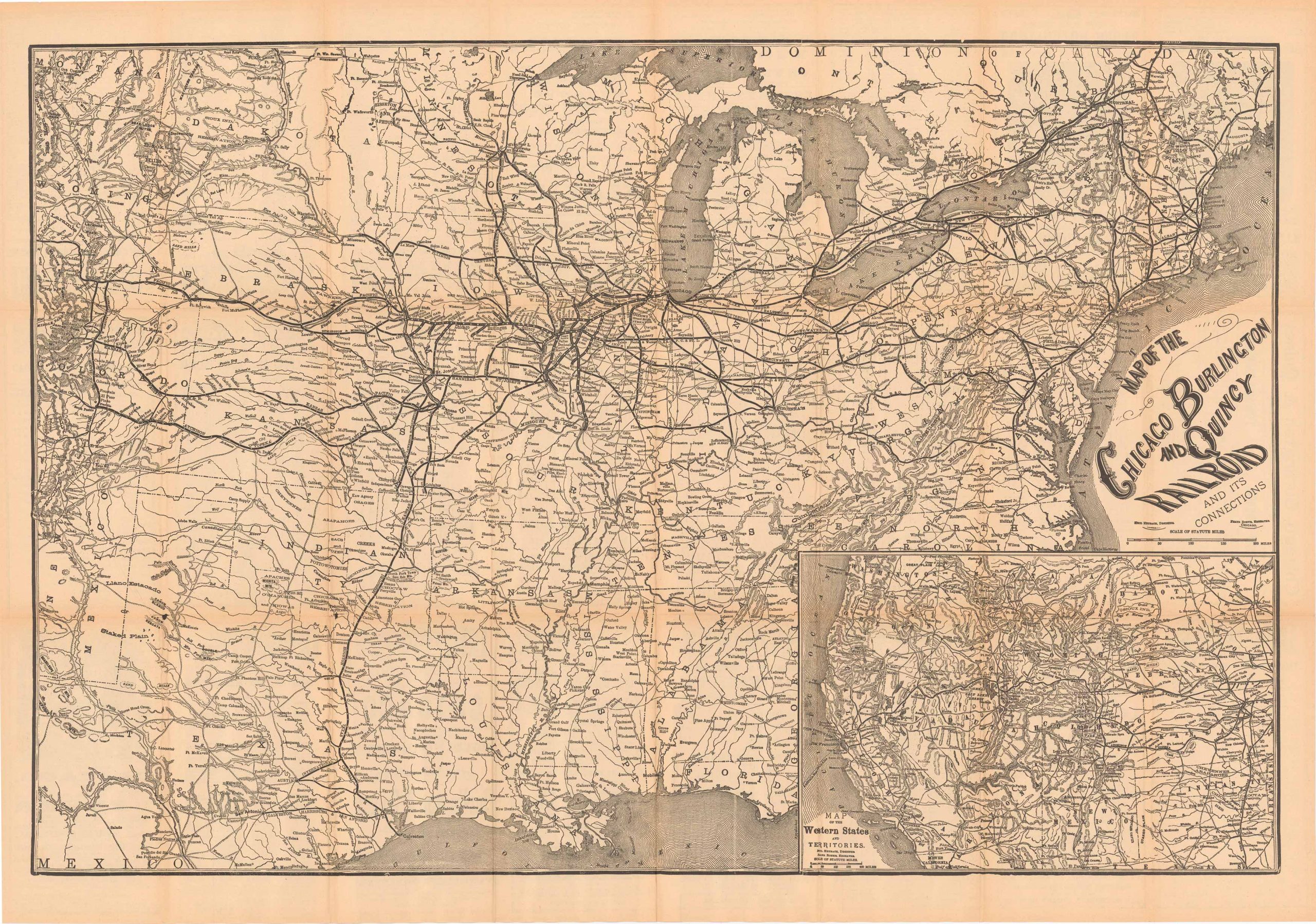
Map of the Chicago Burlington and Quincy Railroad and its Connections
In stock
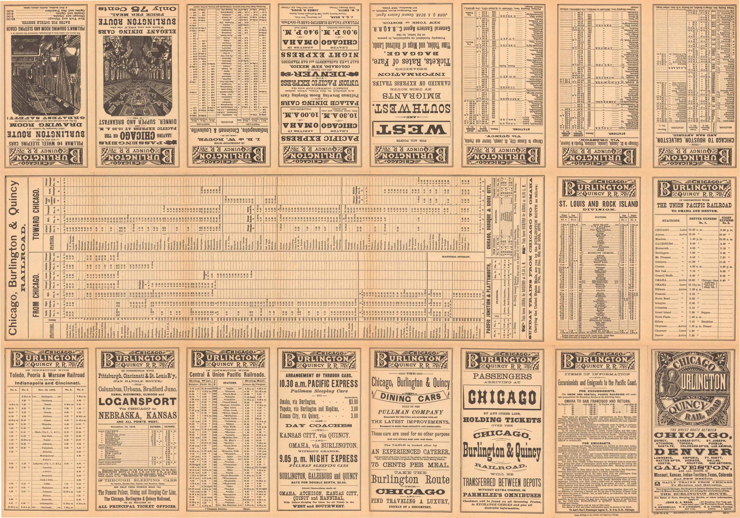
A map that usually suffers wear, here is solid and mildly toned. Showing us not only the routes of the CB&Q, this map gives us towns, hydrography as well as topography. A large inset contextualizes the rail lines with connecting routes to California and the west coast. The verso is full of advertising of routes, schedules and rates. A rare map made intended as an enticement for quick and easy travel to the western states and territories. Condition very good.
Size: 26.5 x 20 inches
Condition: Very Good
Map Maker: Rand McNally
Coloring: Black and White
Year: 1878
Condition: Very Good
Map Maker: Rand McNally
Coloring: Black and White
Year: 1878
In stock


