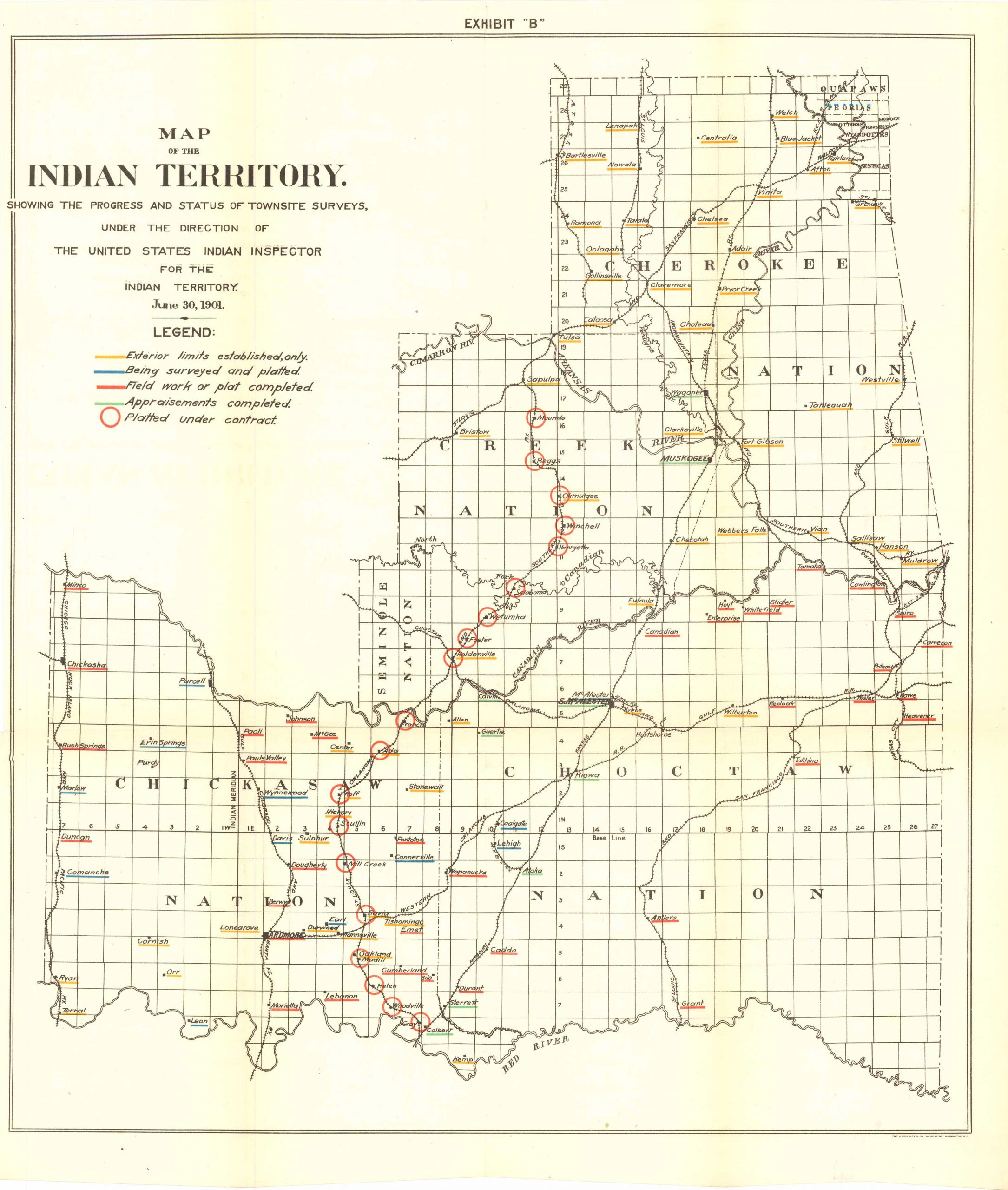
Map of the Indian Territory showing progress and status of townsite surveys, 1901
Out of stock
Map of the Indian Territory showing progress and status of Townsite surveys, under the direction of the United States Indian Inspector for the Indian Territory, June 30th, 1901. This detailed map comes with a legend indicating what the various colored lines and circles represent, along with all of the townships in the area, the Choctaw Nation, Chickasaw Nation, Seminole Nation, Creek Nation and the Cherokee Nation. Also shown are various natural features such as the Arkansas River. This maps coloring is still vibrant and bright.
Size: 18 x 21.25 inches
Condition: Very good
Original Production Year: 1901
Coloring: Printed Color
Year: 1901
Condition: Very good
Original Production Year: 1901
Coloring: Printed Color
Year: 1901
Out of stock


