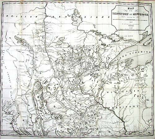
Map of the Territory of Minnesota Exhibiting the route of the expedition to the Red River of the North, In the Summer of 1849
Out of stock
This is a masterpiece of early territorial mapping. In 1849, Capt. John Pope set out to explore the area of Minnesota, with the intent of unveiling the area for settlers, finding a good point to establish a fort, as well as to chart the headwaters of the Mississippi river. In doing so, he also proposed railway routes that would allow tapping into the prairies and exporting through the port of Duluth. Flooded with practical notations of native settlements, trading posts, waterways and lakes, points of portage, and more, this map is an amazing accomplishment. Condition is good on this very scarce and desirable map, with some minor sporadic foxing, and a close margin on the lower left corner.
Size: 28 x 24.5 inches
Condition: Good - minor foxing
Map Maker: Capt. John Pope
Coloring: Black and White
Year: 1849
Condition: Good - minor foxing
Map Maker: Capt. John Pope
Coloring: Black and White
Year: 1849
Out of stock


