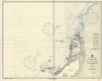
May Penn – The Alley, Jamaica – Sheet H
In stock
Published by Directorate of Colonial Surveys, Jamaica and printed in 1953, this topographical map is part of a series of sheets that divides the island of Jamaica into sections. There is an index to adjoining sheets on each map for reference. Along with topographical land contours, other details on this map indicate roads, buildings, railways (stations and bridges), rivers, lakes, bridges, forest areas, and any plantation areas. This sheet covers the central, southern portion of Jamaica of Portland Ridge up to May Penn and from the Carpenters Mountains over to Bushy Park region.
Size: 39 x 28.5 inches
Condition: Good, age toning and foxing on fold lines
Map Maker: Directorate of Colonial Surverys, Jamaica
Coloring: Printed Color
Year: 1953
Condition: Good, age toning and foxing on fold lines
Map Maker: Directorate of Colonial Surverys, Jamaica
Coloring: Printed Color
Year: 1953
In stock


