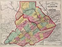
- You cannot add another "Counties of Clinton & Centre (Pennsylvania)" to your cart. View cart
 |
||
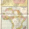
N.W. Africa, Morocco, Algeria, and Tunis – Africa
Out of stock
This map was made by George F. Cram for “Crams Unrivaled Family Atlas” in 1883. North West Africa, Morocco, Tunis, and Algeria are illustrated on the top map on this page.The main map shows all of Africa. Countries and territories are distinguished by color. Other details include the names of important cities, countries, and regions, common sea routes, rivers, lakes, and mountains.
Size: 11.5 x 20 inches
Condition: Very Good
Map Maker: George F. Cram
Coloring: Printed Color
Year: 1883
Condition: Very Good
Map Maker: George F. Cram
Coloring: Printed Color
Year: 1883
Out of stock