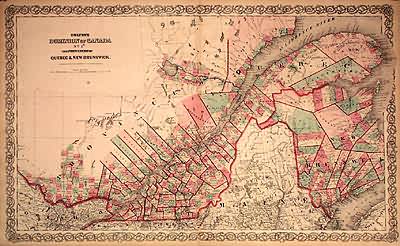
Coltons Dominion of Canada No.1, The Provinces of Quebec & New Brunswick.
In stock
Art Source International is proud to offer this map from the 1868 edition of Coltons General Atlas. Colton atlases, especially those from the late 1860’s, have become increasingly rare. These well maintained examples are the first for sale by our store in eight years. The General Atlas was the first single edition atlas published by the Colton brothers succeeding the expensive two volume Atlas of the World. These maps have the signature ‘ inch Colton border surrounding each map. The Colton firm refused to compromise quality, choosing to compete for sales in the finer quality international market rather than the inexpensive domestic one. Because of this, all maps were engraved by steel plates rather than by wax engraving which was the most common method used at this time. This map of the provinces of Quebec and New Brunswick is very detailed with identification of regions, important cities, rivers, lakes, mountain ranges, and railroad lines. Each map has beautiful muted red, green, tan, pink, and yellow hand coloring used to distinguish regions. ‘
Condition: Very Good-age toning, very minor foxing
Map Maker: G.W. & C.B. Colton
Coloring: Original Hand Color
Year: 1868
In stock


