- You cannot add another "Mile High Lakes Quadrangle, Colorado" to your cart. View cart
 |
||
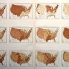
Number of Deaths From Principal Diseases per 1000 Deaths From Known Causes
Out of stock
This map was made in Washington D.C. in 1898 by the Department of the Interior based on results of the eleventh census. The number of deaths from various diseases per 1000 deaths from combined known causes throughout the country are illustrated on these maps. The names of states and important cities, rivers, and lakes are shown.
Size: 28.25 x 17.5 inches
Condition: Very Good- seperation at center fold
Map Maker: Department of the Interior
Coloring: Chromolithograph
Year: 1898
Condition: Very Good- seperation at center fold
Map Maker: Department of the Interior
Coloring: Chromolithograph
Year: 1898
Out of stock