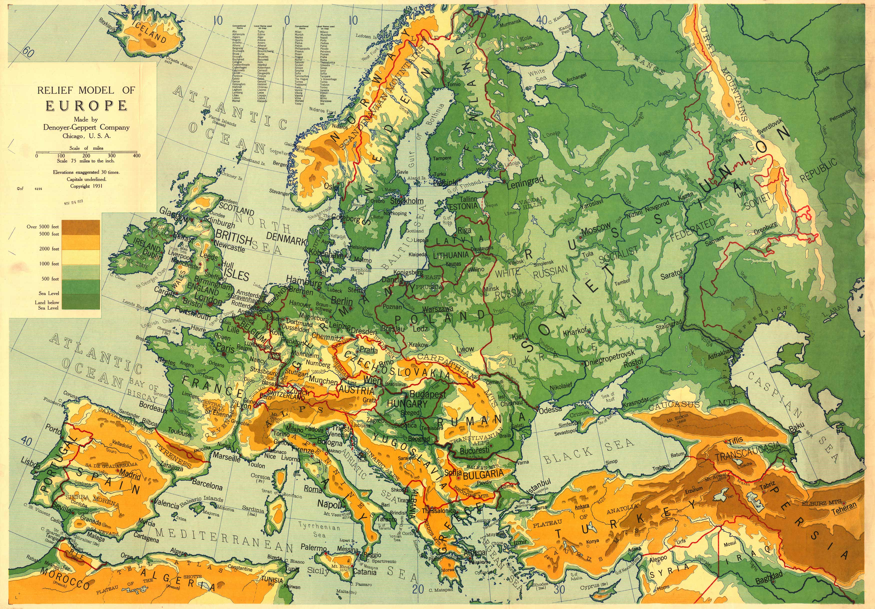
Relief Model of Europe
Out of stock
This “Relief Model of Europe” map was published in 1931 by the Denoyer-Geppert Company, Chicago. It shows elevations exaggerated 30 times and underlined capitals. This is a very interesting map showing national borders between the World Wars. Of particular interest is the eastern Europe and western Russia region, with multiple regional names, including Russia, Ukraine, Transcaucasia, White Russia, Soviet Union, and Russian Socialist Federated Soviet Republic.
Size: 46 x 32 inches
Condition: Very Good - slight staining, paper distress, ink stamp
Map Maker: Denoyer-Geppert Company, Chicago
Coloring: Printed Color
Year: 1931
Condition: Very Good - slight staining, paper distress, ink stamp
Map Maker: Denoyer-Geppert Company, Chicago
Coloring: Printed Color
Year: 1931
Out of stock


