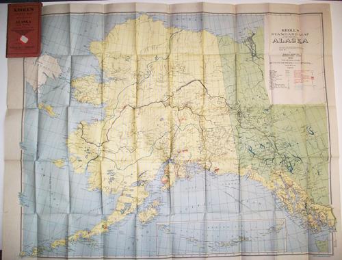
Krolls Pocket Map of Alaska & Yukon’
In stock
This is a large, colorful map produced by Kroll Map Company, titled “Krolls Pocket Map and Traveller’s Guide of Alaska and Yukon, compiled from the latest government surveys and with the assistance of prominent Alaska men.” This detailed folding map shows railroads, wagon roads, highways, waterways, gold, coal & copper mines as well as many other important landmarks. The map also includes an inset of the Aleutian Islands. The Kroll Map Company started in 1912 in Seattle and is still in business today. This map is in it’s original red paper covers.
Size: 37 x 29.25 inches
Condition: Very Good
Map Maker: Kroll Map Company
Coloring: Printed Color
Year: 1920
Condition: Very Good
Map Maker: Kroll Map Company
Coloring: Printed Color
Year: 1920
In stock


