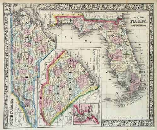
County Map of Florida, South Carolina and North Carolina
In stock
The Mitchell Company was one of the first to experiment with steel plate engraving techniques, doing so nearly 20 years before the rest of the publishing industry. Mitchell was printing with steel in the early 1830’s, though the industry at large did not switch to steel until about 1850. During the early years of the company, Mitchell published mainly maps and travel guides. In 1860, he started producing “Mitchell’s New General Atlas”, and Mitchell Sr. retired and turned the business over to his son of the same name. “The New General Atlas” was published until 1893. Today Mitchell maps are sought after for their fine engraving, bright coloring, and attention to detail. They are some of the finest maps produced in the 1860’s. This map, produced in 1864, shows Mitchell’s famous floral border, which is only seen in the early editions of his atlases. This map shows Michigan and Wisconsin and details railroads, proposed railroads, cities, towns, rivers, mountains, Native American tribes, wagon trails, forts and counties.
Condition: Very Good
Map Maker: S. Augustus Mitchell
Coloring: Original Hand Coloring
Year: 1864
In stock


