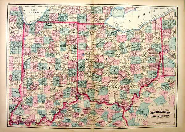
Asher & Adams Ohio & Indiana’
In stock
This map is from Asher & Adams” “New Statistical and Topographical Atlas of the World.” This atlas is unique in its vivid hand coloring and easy to read town names. Asher & Adams had this to say in their forward: “The erroneous method of crowding and burdening maps with a vast amount of names, blurring the page and obscuring the places they should bring to view” has been discarded in this work.” This map of Ohio & Indiana pays particular attention to railroads, railroad stations, rivers, and numerous cities and towns.
Size: 22.25 x 16 inches
Condition: Very Good � with uniform browning to margins, not affecting maps
Map Maker: Asher & Adams
Coloring: Hand Colored Copper Engraving
Year: 1872
Condition: Very Good � with uniform browning to margins, not affecting maps
Map Maker: Asher & Adams
Coloring: Hand Colored Copper Engraving
Year: 1872
In stock


