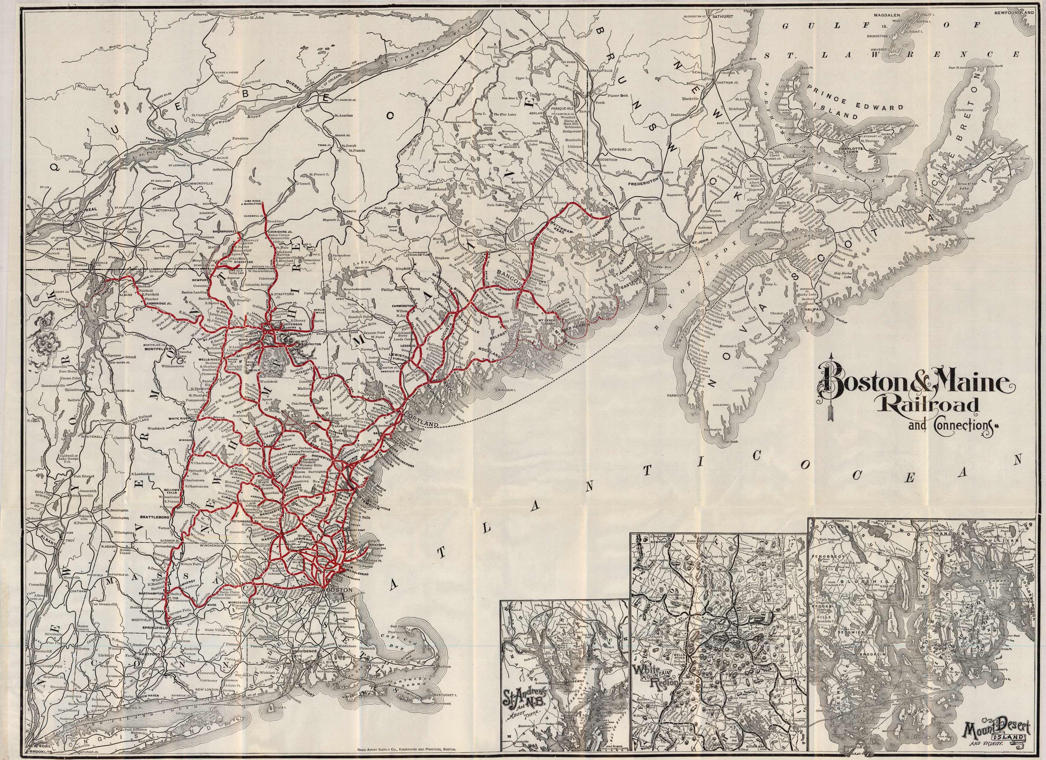
Boston & Maine Railroad and Connections
In stock
This 1898 Rand McNally map charts all Boston & Maine Railroad destinations. It shows major drainage, cities, towns, state boundaries, and the railroad network. In the insets (from left to right), the map shows St. Andrews and N.B, the White Mountain Region, and the Mount Desert Island and Vicinity. It stretches as far north as Newfoundland and the Gulf of St. Lawrence and as far south as Long Island. At the end of 1970, the B&M operated 1,515 route-miles on 2,481 miles of track and 92 million passenger-miles.
Size: 30 x 37.5 inches
Condition: Excellent
Map Maker: Rand McNally & Co.
Coloring: Printed Color
Year: 1898
Condition: Excellent
Map Maker: Rand McNally & Co.
Coloring: Printed Color
Year: 1898
In stock


