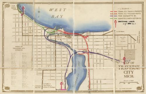
Map of Traverse City, Michigan, 1944
Out of stock
This 1944 folding pocket map of Traverse City, Michigan identifies streets, train tracks, lakes, fair grounds, government buildings,high school, and contains beach directions. This particular map shows the West Bay. AAA issued this map. AAA started in 1902
Size: 15.75 x 10 inches
Condition: Very Good - some age toning
Map Maker: AAA
Coloring: Original Hand Coloring
Year: 1944
Condition: Very Good - some age toning
Map Maker: AAA
Coloring: Original Hand Coloring
Year: 1944
Out of stock


