 |
||
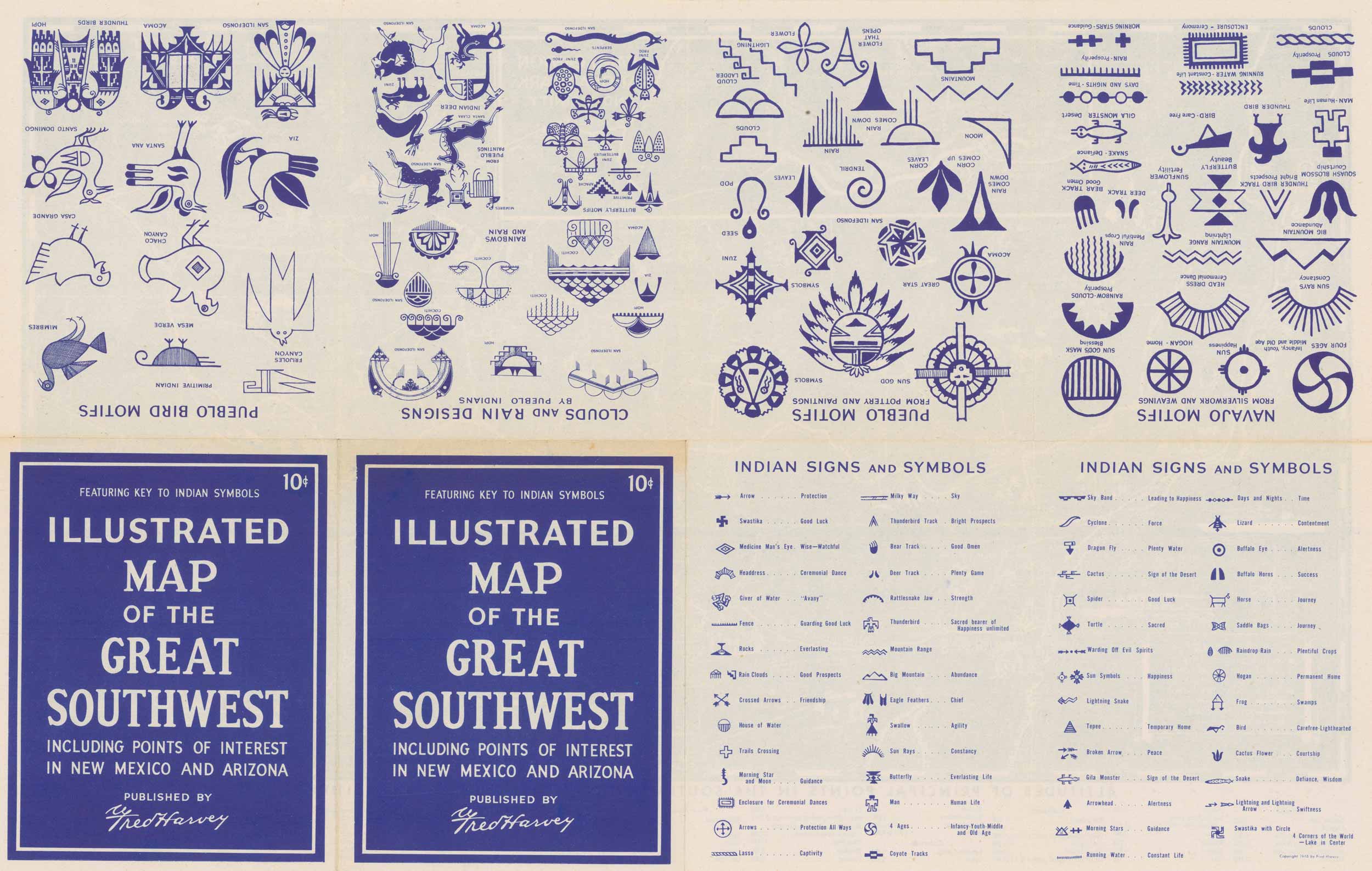
1946 Illustrated Map of the Great Southwest
Out of stock
1946 Fred Harvey map, “Illustrated Map of the Great Southwest, Including Points of Interest in New Mexico and Arizona. Featuring Key to Indian Symbols.” This map provides a detailed pictorial image of the American Southwest, with an inset of Grand Canyon National Park. Altitudes of principal points in the Southwest and various American cities are listed.
Size: 22 x 14 inches
Condition: Very Good
Map Maker: Fred Harvey
Year: 1946
Condition: Very Good
Map Maker: Fred Harvey
Year: 1946
Out of stock


