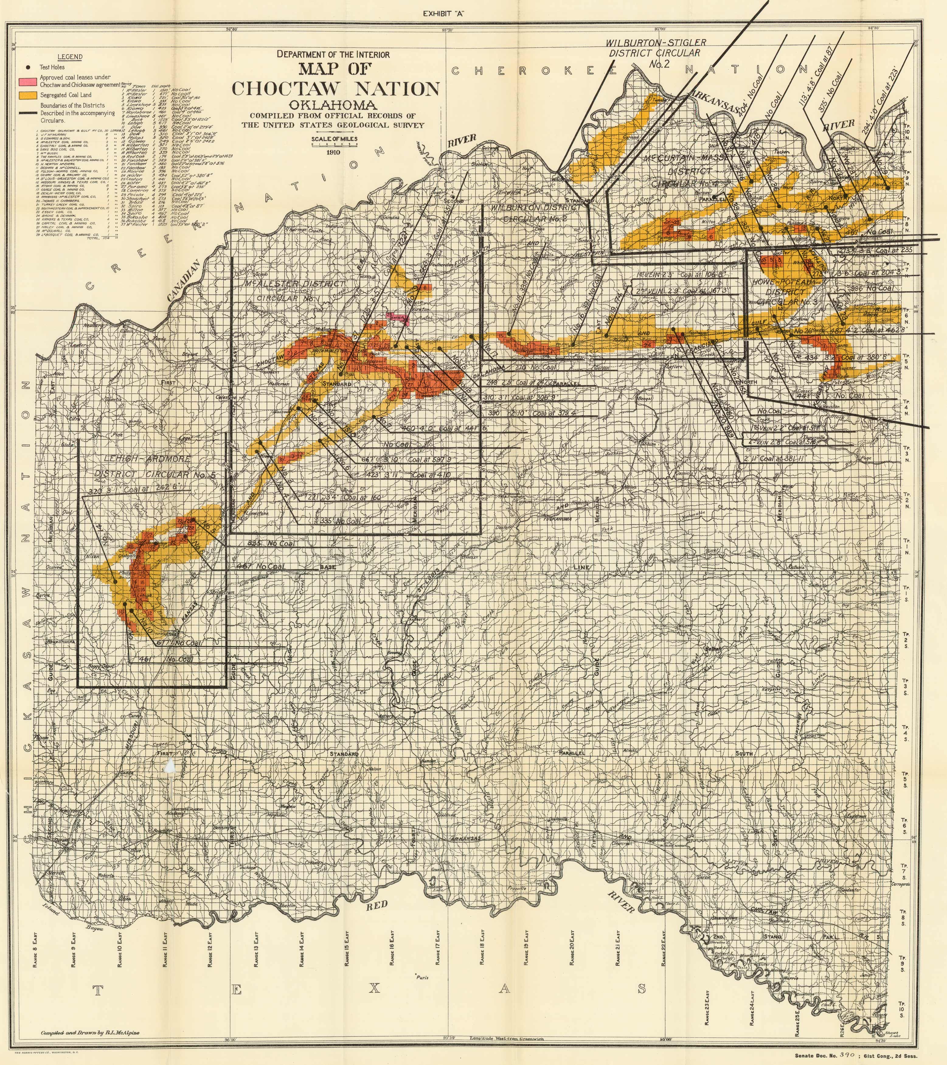
Map of the Choctaw Nation – Oklahoma
In stock
This 1910 Department of the Interior “Map of the Choctaw Nation – Oklahoma” was “compiled from official records of the United States Geological Survey”. It shows segregated coal land, approved coal leases under Choctaw and Chickasaw agreement, and test holes.
Size: 25.5 x 29.5 inches
Condition: Very Good - some paper separation and creasing along folds
Map Maker: Department of the Interior
Coloring: Printed Color
Year: 1910
Condition: Very Good - some paper separation and creasing along folds
Map Maker: Department of the Interior
Coloring: Printed Color
Year: 1910
In stock


