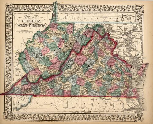
County Map of Virginia and West Virginia
In stock
S. Augustus Mitchell,Jr. made this hand colored map for Mitchells New General Atlas in 1870. Virginia and West Virginia are illustrated on this map. Counties are distinguished by bright pastel colors. Other details include the names of counties, important cities, railroads, proposed railroads, and major roads.
Size: 14.5 x 11.75 inches
Condition: Very Good-age toning, small margins
Map Maker: S. Augustus Mitchell
Coloring: Original Hand Color
Year: 1870
Condition: Very Good-age toning, small margins
Map Maker: S. Augustus Mitchell
Coloring: Original Hand Color
Year: 1870
In stock


