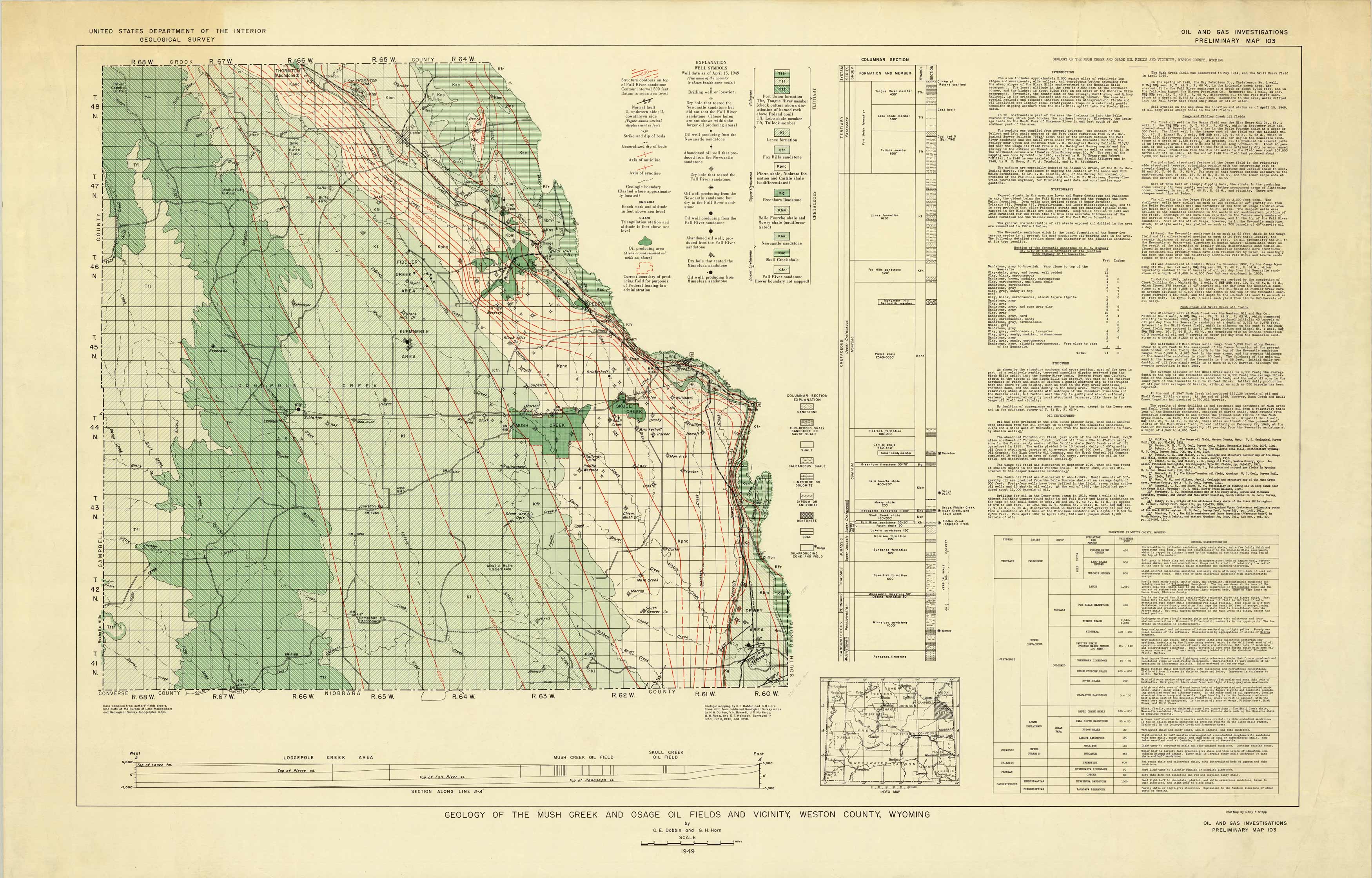
Geology of the Mush Creek and Osage Fields and Vicinity, Weston County, Wyoming
In stock
Published in 1949 by the Department of the Interior Geological Survey, this geology map of the Mush Creek and Osage Oil fields is packed with detail and explanation. Details on the map indicate tertiary and cretaceous sedimentary and rocks, oil producing areas, axis of anticline and syncline, structure contours, drilling well, abandoned oil well produced from each area and more. There is a columnar section with explanation and a chart of the formations in Weston county that identifies general characteristics. Detailed descriptions of the structure, oil development, Osage and Fiddler Creek oil fields and Mush Creek and Skull Creek oil fields is included in text form on the map.
Size: 46.25 x 28.75 inches
Condition: Very Good, light age toning and foxing
Map Maker: Department of the Interior Geological Survey
Coloring: Printed Color
Year: 1949
Condition: Very Good, light age toning and foxing
Map Maker: Department of the Interior Geological Survey
Coloring: Printed Color
Year: 1949
In stock


