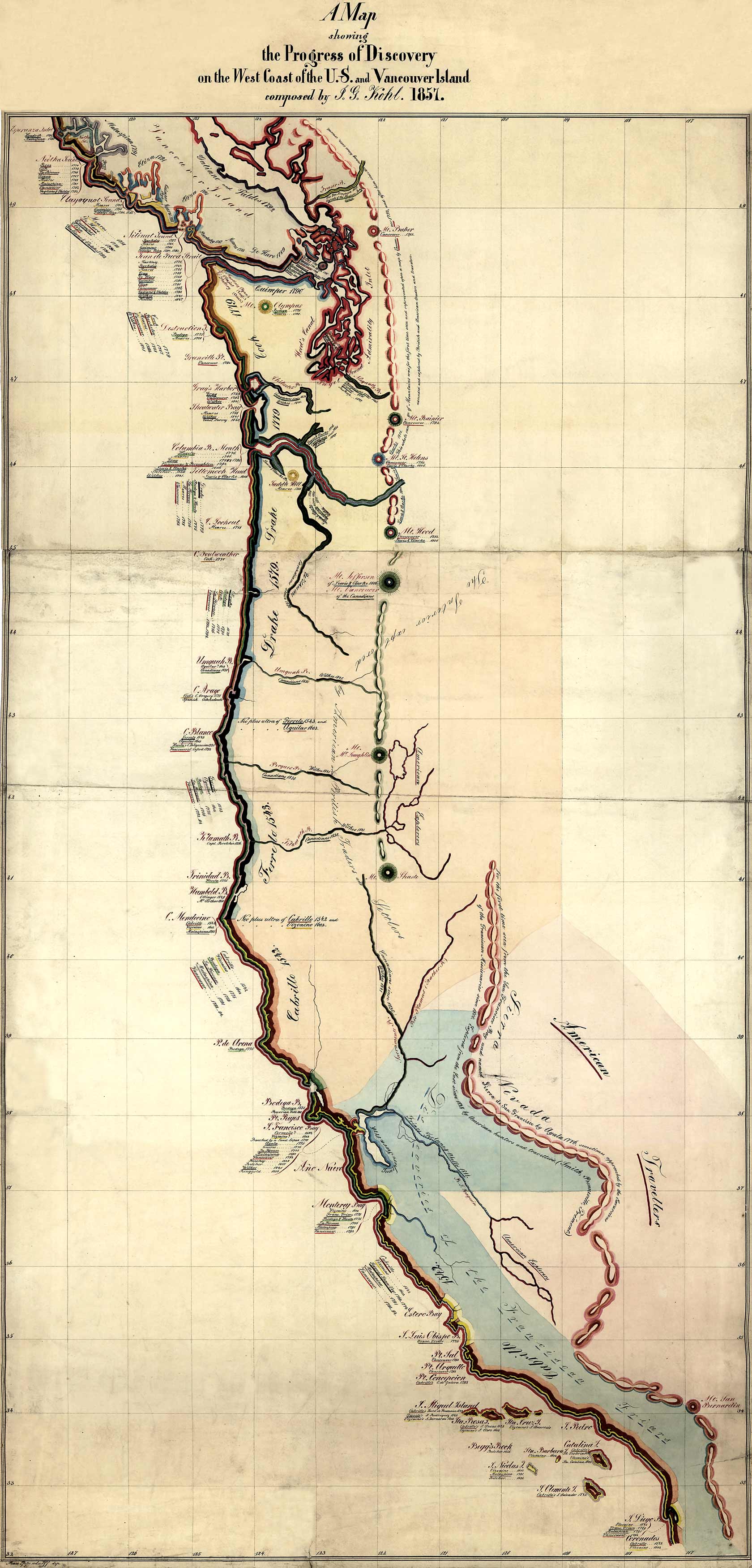
In this beautiful 1857 map by J.G. Kohl, Kohl depicts explorations of the west coast using colored lines. Kohl’s notes include, Sierra Nevada: for the first time seen from the San Francisco Bay and named Sierra de San Francisco by Ayala 1776, sometimes approached by the Excursions of the Franciscan Missionaries since 1800. Explored from the East since 1828 by American hunters and travelers.” Of Mt. St. Helens he wrote, “This whole range of Mountains was for the first time seen and represented on a map by Vancouver 1792, and after him since 1811, many times seen, crossed, ascended, and explored by British and American traders and travelers.””
Additional information
| Weight | 0.25 lbs |
|---|---|
| Dimensions | 11.5 × 24 × 0.002 in |
Map Maker: J.G. Kohl
Original Production Year: 1857
Original Production Year: 1857


