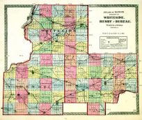
Map of the World showing principal Telegraph Lines, Steamship Routes and Continental Railroads.
In stock
These handsomely hand colored maps are from the 1896 Johnsons Universal Cyclopedia. Hand coloring from this time frame are rare. The small size of these maps allow for excellent framing. This map of the world shows principal telegraph lines, steamship routes and continental railroads.
Size: 12 x 9.5 inches
Condition: Very Good
Map Maker: A.J Johnson
Coloring: Original Hand Coloring - Copper plate engraving
Year: 1896
Condition: Very Good
Map Maker: A.J Johnson
Coloring: Original Hand Coloring - Copper plate engraving
Year: 1896
In stock


