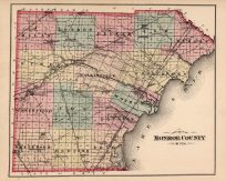
- You cannot add another "Outline Plan of Monroe County, Mich." to your cart. View cart
 |
||
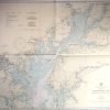
Chesapeake Bay- Sandy Point to Head of Bay
Out of stock
This coastal survey was printed in Washington D.C. in 1944 by the U.S. Coast and Geodetic Survey.Chesapeake Bay between Sandy Point and Head of Bay is shown on this map. Details include important cities, monuments, buildings,railroads,and parks along the coast, depth readings, and bridges.This map would make a great gift for a resident of the area. Note on Map: “Warning: Aids to Navigation may be altered, interrupted or removed without notice. In general, temporary changes due to war conditions are not incorporated on the chart. “The waters within the boundary line shown thus…are restricted. Danger from high explosive firing and bombing.”
Condition: Excellent
Map Maker: U.S. Coast and Geodetic Survey
Coloring: Machine Color
Year: 1944
Out of stock